End of Week Links
- Making Plans
- Tidal power feeds electricity to National Grid in world first
- Vehicle Miles Traveled & Foreign Oil
- The Carfree Census Database
- On Oil Speculation and Demand (demand, not speculation is driving prices)
- Alsop’s designs for Putney towers
- Gormley and Chipperfield three-way pavilion opens in Sweden
New Port Authority Designs Unveiled

Left, Pelli Clarke Pelli Architects; Rogers Stirk Harbour & Partners; Kohn Pedersen Fox Architects
Designs Unveiled for Tower Above Port Authority Bus Terminal by Richard Rogers, Cesar Pelli, and Kohn Pedersen Fox Architects:
The on-again, off-again plans to build an office tower over the north wing of the Port Authority Bus Terminal took at least a conceptual step forward on Thursday with the unveiling of competing designs by three leading architectural firms.
Easily the most striking is a 42-story constructivist assemblage by the London firm Rogers Stirk Harbour & Partners, which is also designing Tower 3 at the World Trade Center site. It takes the form of four discrete boxes stacked atop one another and bound together by open diagonal trusswork that echoes the bold X-shaped steel braces girdling the main terminal below.
In complete contrast, for its suavity and lucidity, is a proposal by the Manhattan firm Kohn Pedersen Fox Architects. The central element of this plan is a sheer, glass-clad, 48-story tower whose surface has an almost icy gleam. In this plan, the X braces would recede in importance behind a screen.
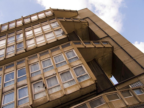
Robin Hood Gardens Design Competition Results Announced
 Robin Hood 05.jpg, originally uploaded by joseph beuys hat
The top entries in BD and the Architecture Foundation’s ideas competition for Robin Hood Gardens show that inspired refurbishment of the estate can give it a new vibrancy while reaching the required density levels.
Check out Zoran Radivojevic’s design for Robin Hood Gardens in depth and the rest of the competition finalists and an interesting proposal from Super Spatial involving kinetic parasitic structures.
See Also:
Centro Cívico de San Cristóbal en Venezuela
 Ventanas cívicas, originally uploaded by Kevin Vásquez "AURINEGRO"
After the Sickness, Links
- Herzog & de Meuron’s revised Tate Modern extension revealed
- The Sub-Neighborhoods of Greenpoint, Brooklyn
- A survey of wind turbines
- Stuck in Traffic: Free-Market Theory Meets the Highway Lobby
- Embodied energy and LEED Buildings
- Olafur Eliasson Artkrush Interview
- A pictorial chronology of the Burj Dubai’s changing proposed height
CCTV rising above Sanhuan Beijing
 CCTV rising above Sanhuan Beijing, originally uploaded by Bruce in Beijing
End of the Suburbs?
Richard Florida says that The days of urban sprawl are over:
What’s happening here goes a lot deeper than the end of cheap oil. We are now passing through the early development of a wholly new geographic order – what geographers call “the spatial fix” – of which the move back toward the city is just one part.
Suburbanization was the spatial fix for the industrial age – the geographic expression of mass production. Low-cost mortgages, massive highway systems and suburban infrastructure projects fuelled the industrial engine of postwar capitalism, propelling demand for cars, appliances and all sorts of industrial goods.
The creative economy is giving rise to a new spatial fix and a very different geography – the contours of which are only now emerging. Rising fuel costs are one thing, but in today’s idea-driven economy, it’s time costs that really matter. With the constant pressure to be more efficient and to innovate, it makes little sense to waste countless collective hours commuting. So the most efficient and productive regions are the ones in which people are thinking and working – not sitting in traffic. And, according to detailed research by the Nobel Prize-winning economist Daniel Kahneman, commuting is among the least enjoyable, if not the single least enjoyable, of all human activities.
What is implied but not expressly stated, is that the suburban sprawl of the last 60 years was enabled and fueled by the subsidization of basically free transportation by the federal government. The suburban condition is not a natural state as has been often stated by suburban apologists, developers and the construction industry. It is only natural that a correction is happening, especially in light of our energy situation.
Neue Nationalgalerie Berlin Interior
 neue nationalgalerie / berlin, originally uploaded by kissing_the_beehive
Columbus Historical Landuse Diagram
As my previous post, Minimum FAR for Walkable Urbanity & Westerville, Ohio discussed, there is a minimum floor for walkable urbanity
; an urban situation where density reaches critical mass allowing all of the Jane Jacobs virtuous effects of urbanism to form: independence from the automobile, more eyes on the street, etc.
Below is a historical survey of four different Columbus, Ohio area residences and one Brooklyn, NY residence. These diagrams are figure-ground relationships illustrating the lot, setbacks (front, side & rear) and house size.
- East Coast Urban Lot
- Midwest Urban lot – German Village
- First Suburbs – Huber Ridge
- Reagan Suburbs – Dublin
- Midwest Exurbs – Dublin

Note how large the lots have become throughout the years, and the location of the house in context of the lot itself.
Upcoming diagrams will argue that the large front yards of newer developments are both wasted space and are a principle reason why Suburban landuse isolates their homeowners.